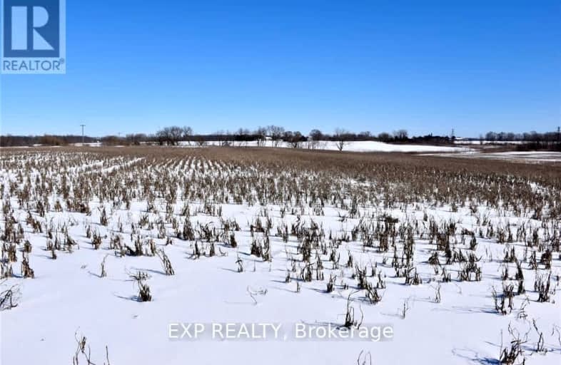
15686 Muirkirk Line, Chatham-Kent | Image 1

15686 Muirkirk Line

Chatham-Kent, Muirkirk

  • Commercial

$1,963,500
For Sale

Added 3 days ago

Sign in or Register • To view all data & photos, an account is required by the Toronto Real Estate Board.
  • Type: Farm

  • Property Type: Commercial

  • Business Type: Cash Crop

  • Zoning: Agricultural

  • Age: No Data

  • Taxes: 4200

  • MLS®#: X11978204

  • Days on Site: 1 Days

  • Added: Feb 18, 2025 (3 days ago)

  • Updated:

  • Last Checked: 3 hours ago

  • Listed By: EXP REALTY

This picturesque 85-acre farm offers a serene and tranquil setting, perfect for agricultural or recreational pursuits. Recently tiled, the land boasts excellent soil for growing soybeans, corn, and wheat. The 21-acre front field is Brookston Sandy Loam while the back field is Brookston Clay. The property features a well-insulated 48' x 64' workshop with bifold door and 14' eves, a second dry storage shed built in 2015 with bifold door (48 X 64) also with 14' eves, a larger building 60 X 60, a chicken barn (64 X 25) that has not been in use in recent years, as well as a smaller drive-in shed. Conveniently located just five minutes from Exit 117 off Highway 401, this farm combines productivity with accessibility, making it a fantastic opportunity for farmers and investors alike. Note there is no home on the property but plenty of space to build one.

Property

  • Status: Sale

  • Type: Cash Crop

  • Property Type: Farm

  • Property Type: Agricultural

  • Area: Chatham-Kent

  • Community: Muirkirk

  • Availability Date: 30-60 days/tba

Utilities

  • Utilities: No

Building

  • Water Supply: None

Fees

  • Tax Year: 2024

  • Tax Legal Description: Pt Lt 16 Con 4 Orford as in 238902, N of Pt 1 24R8769; Chatham-K

  • Taxes: $4,200

  • Taxes Type: Annual

Land

  • Cross Street: Muirkirk Line/MacPhe

  • Municipality District: Chatham-Kent

  • Parcel Number: 006630063

  • Lot Depth: 828.71 Feet

  • Lot Frontage: 1998.39 Feet

  • Lot Irregularities: Irregular - 2 lots

  • Zoning: Agricultural

Commercial Specific

  • Total Area: 85

  • Total Area Metric: Acres

  • Lot Code: Lot

7-8

Ridgetown DHS-Gr. 7 & 8

Elementary: Public
14.03 km
JK-8

Zone Township Central School

Elementary: Public
15.45 km
JK-8

St Mary's

Elementary: Catholic
15.09 km
JK-8

St Michael Catholic School

Elementary: Catholic
15.35 km
JK-8

Aldborough Public School

Elementary: Public
7.60 km
JK-6

Naahii Ridge Public School

Elementary: Public
13.34 km
9-12

Glencoe District High School

Secondary: Public
24.26 km
9-12

Ridgetown District High School

Secondary: Public
14.02 km
9-12

Lambton Kent Composite School

Secondary: Public
35.55 km
9-12

West Elgin Secondary School

Secondary: Public
14.81 km
9-12

Blenheim District High School

Secondary: Public
29.17 km
9-12

John McGregor Secondary School

Secondary: Public
38.09 km