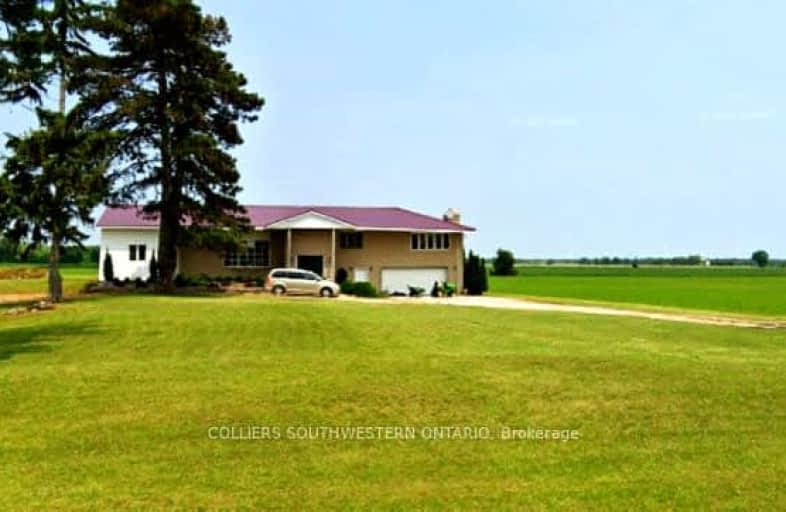
19167 Bury Road, Chatham-Kent | Image 1

19167 Bury Road

Chatham-Kent, Muirkirk

  • Commercial

$X,XXX,XXX
For Sale

Added 1 day ago

Sign in or Register • To view all data & photos, an account is required by the Toronto Real Estate Board.
  • Type: Farm

  • Property Type: Commercial

  • Business Type: Cash Crop

  • Zoning: A1

  • Age: No Data

  • Taxes: 4344.63

  • MLS®#: X11938799

  • Added: Jan 24, 2025 (1 day ago)

  • Updated:

  • Last Checked: 2 hours ago

  • Listed By: COLLIERS SOUTHWESTERN ONTARIO

Excellent opportunity to add to your existing land base or begin your farming operation with this 52+/- acre farm in a prime agricultural location. 50 +/- acres level workable acres of Berrien sandy loam (Be.t) which are classified as Class 1 and considered prime agricultural land with no significant limitations for crop production. these soils are highly fertile, well-drained, and capable of supporting a wide range of field crops, including corn, soybeans, and small grains, as well as some specialty crops like fruits & vegetables. their versatility and productivity make them ideal for intensive agricultural use. Cornwall municipal drain runs through property. house on property is being sold 'as is' condition.

Property

  • Status: Sale

  • Type: Cash Crop

  • Property Type: Farm

  • Property Type: Agricultural

  • Area: Chatham-Kent

  • Community: Muirkirk

  • Availability Date: IMMEDIATE

  • Assessment Amount: $606,000

  • Assessment Year: 2024

Utilities

  • Utilities: Yes

Building

  • Heat Type: Other

  • Water Supply: Well

Parking

  • Garage Type: Other

Fees

  • Tax Year: 2024

  • Tax Legal Description: PT LT 66 CON NORTH TALBOT ROAD ORFORD AS IN OR8486 EXCEPT PT 6,

  • Taxes: $4,345

  • Taxes Type: Annual

Land

  • Cross Street: HWY 3 (TALBOT TRAIL)

  • Municipality District: Chatham-Kent

  • Parcel Number: 006690011

  • Sewer: Septic

  • Lot Depth: 636.92 Feet

  • Lot Frontage: 3304.9 Feet

  • Zoning: A1

Commercial Specific

  • Rail: N

  • Total Area: 52.85

  • Total Area Metric: Acres

  • Tangible Property Included: N

  • Lot Code: Lot

  • Financial Statement: N

7-8

Ridgetown DHS-Gr. 7 & 8

Elementary: Public
10.97 km
JK-8

Zone Township Central School

Elementary: Public
22.43 km
JK-8

St Mary's

Elementary: Catholic
20.57 km
JK-8

St Michael Catholic School

Elementary: Catholic
11.79 km
JK-8

Aldborough Public School

Elementary: Public
13.01 km
JK-6

Naahii Ridge Public School

Elementary: Public
10.28 km
9-12

Glencoe District High School

Secondary: Public
32.25 km
9-12

Ridgetown District High School

Secondary: Public
10.97 km
9-12

West Elgin Secondary School

Secondary: Public
20.15 km
9-12

Blenheim District High School

Secondary: Public
24.12 km
9-12

John McGregor Secondary School

Secondary: Public
35.82 km
9-12

Chatham-Kent Secondary School

Secondary: Public
36.49 km