Added 6 months ago

-
Type: Vacant Land
-
Lot Size: 857.11 x 1654.8 Feet
-
Age: No Data
-
Taxes: $400 per year
-
Added: Dec 18, 2024 (6 months ago)
-
Updated:
-
Last Checked: 3 months ago
-
MLS®#: X11895916
-
Listed By: Coldwell banker electric realty
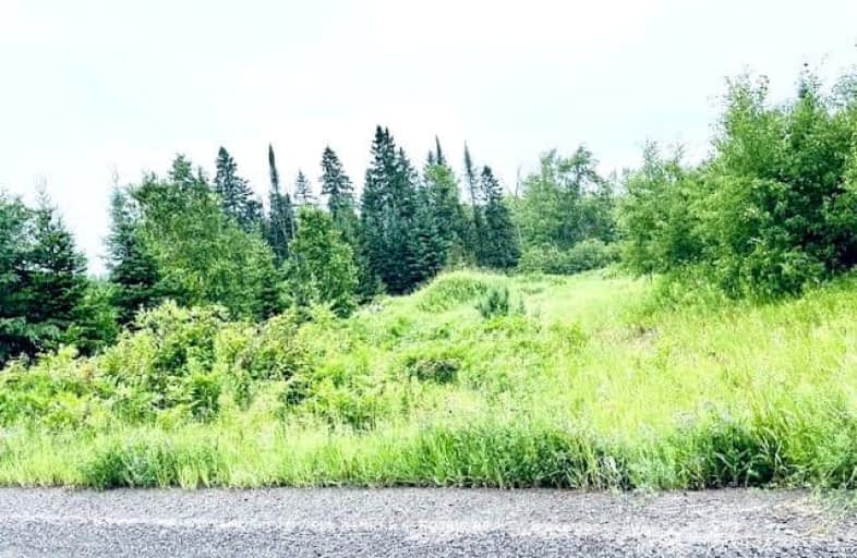
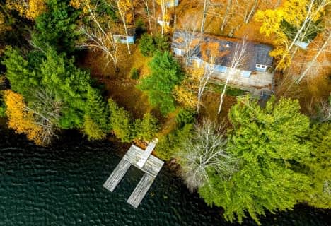
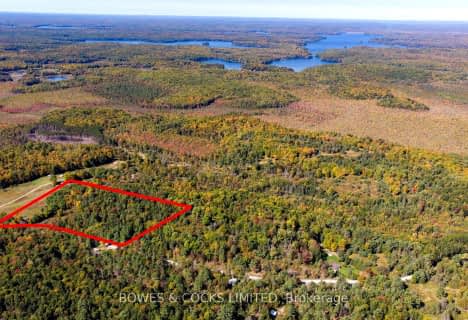
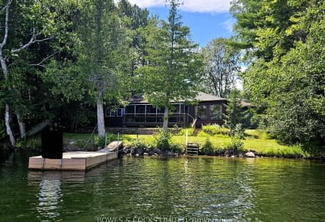
If you are looking for a nice private place to enjoy nature then this is it! This land is approximately 33.8 Acres with 100 acres of Crown Land accessible at the rear of property, in a lovely quiet area. Some Rocky areas, some meadows, lots of mixed bush. Hydro is on the south side of Lasswade Road just across the road from this property. Trails throughout for your ATV. Close to Apsley (15 min) or Havelock (30min) for amenities. Great fishing and hunting in the area. Close to Chandos and Jack Lake for boating, swimming or fishing. Small area of the land is zoned EC in N/W corner. Please make an appointment to view this property.
Upcoming Open Houses
We do not have information on any open houses currently scheduled.
Schedule a Private Tour -
Contact Us
Property Details
Facts for Lasswade Road, North Kawartha
Property
Status: Sale
Property Type: Vacant Land
Area: North Kawartha
Community: Rural North Kawartha
Availability Date: Immediate
Utilities
Electricity: Available
Gas: No
Cable: No
Telephone: Available
Building
Water Supply: None
Special Designation: Unknown
Fees
Tax Year: 2024
Tax Legal Description: PT LT 22, Con 2, Chandos as in R348579 Except PT 1 PL 45R15130,
Taxes: $400
Highlights
Feature: Part Cleared
Feature: Wooded/Treed
Land
Cross Street: Lasswade Rd & Hwy 46
Municipality District: North Kawartha
Fronting On: North
Parcel Number: 282650222
Sewer: None
Lot Depth: 1654.8 Feet
Lot Frontage: 857.11 Feet
Lot Irregularities: See Geowarehouse map
Acres: 25-49.99
Zoning: RU / EC
Waterfront: None
Access To Property: Yr Rnd Municpal Rd
Easements Restrictions: Conserv Regs
Easements Restrictions: Environ Protectd
Rural Services: Electr On Road
| X1189591 | Dec 18, 2024 |
Active For Sale |
$259,900 |
| X8480286 | Dec 17, 2024 |
Inactive For Sale |
|
| Jun 25, 2024 |
Listed For Sale |
$259,900 | |
| X8141872 | Jul 08, 2024 |
Sold For Sale |
$155,000 |
| Mar 14, 2024 |
Listed For Sale |
$179,900 | |
| X8141844 | Jul 26, 2024 |
Sold For Sale |
$175,000 |
| Mar 14, 2024 |
Listed For Sale |
$179,900 | |
| X6979235 | Sep 15, 2006 |
Sold For Sale |
$34,900 |
| Aug 17, 2006 |
Listed For Sale |
$34,900 | |
| X6978916 | Dec 18, 2024 |
Removed For Sale |
|
| Jun 22, 2006 |
Listed For Sale |
$299,000 | |
| X6978517 | Oct 03, 2005 |
Sold For Sale |
$42,000 |
| Sep 22, 2005 |
Listed For Sale |
$41,000 | |
| X6974313 | May 18, 2005 |
Sold For Sale |
$12,200 |
| May 06, 2005 |
Listed For Sale |
$12,900 | |
| X6974025 | Apr 25, 2005 |
Sold For Sale |
$32,000 |
| Apr 16, 2005 |
Listed For Sale |
$34,500 | |
| X6968375 | Mar 06, 2004 |
Sold For Sale |
$31,000 |
| Feb 28, 2004 |
Listed For Sale |
$29,900 | |
| X6891168 | Aug 29, 2008 |
Sold For Sale |
$15,000 |
| Aug 16, 2008 |
Listed For Sale |
$17,900 | |
| X6877460 | Oct 11, 2005 |
Sold For Sale |
$45,000 |
| Oct 03, 2005 |
Listed For Sale |
$44,900 | |
| X6877164 | Sep 01, 2005 |
Sold For Sale |
$126,000 |
| Aug 18, 2005 |
Listed For Sale |
$159,000 | |
| X6855542 | Oct 11, 2001 |
Sold For Sale |
$62,500 |
| Jul 03, 2001 |
Listed For Sale |
$69,900 | |
| X6345246 | Apr 18, 2012 |
Sold For Sale |
$40,000 |
| Nov 08, 2011 |
Listed For Sale |
$45,000 | |
| X6340428 | Sep 07, 2009 |
Sold For Sale |
$72,000 |
| Aug 21, 2009 |
Listed For Sale |
$64,900 |
| X1189591 Active | Dec 18, 2024 | $259,900 For Sale |
| X8480286 Inactive | Dec 17, 2024 | For Sale |
| X8480286 Listed | Jun 25, 2024 | $259,900 For Sale |
| X8141872 Sold | Jul 08, 2024 | $155,000 For Sale |
| X8141872 Listed | Mar 14, 2024 | $179,900 For Sale |
| X8141844 Sold | Jul 26, 2024 | $175,000 For Sale |
| X8141844 Listed | Mar 14, 2024 | $179,900 For Sale |
| X6979235 Sold | Sep 15, 2006 | $34,900 For Sale |
| X6979235 Listed | Aug 17, 2006 | $34,900 For Sale |
| X6978916 Removed | Dec 18, 2024 | For Sale |
| X6978916 Listed | Jun 22, 2006 | $299,000 For Sale |
| X6978517 Sold | Oct 03, 2005 | $42,000 For Sale |
| X6978517 Listed | Sep 22, 2005 | $41,000 For Sale |
| X6974313 Sold | May 18, 2005 | $12,200 For Sale |
| X6974313 Listed | May 06, 2005 | $12,900 For Sale |
| X6974025 Sold | Apr 25, 2005 | $32,000 For Sale |
| X6974025 Listed | Apr 16, 2005 | $34,500 For Sale |
| X6968375 Sold | Mar 06, 2004 | $31,000 For Sale |
| X6968375 Listed | Feb 28, 2004 | $29,900 For Sale |
| X6891168 Sold | Aug 29, 2008 | $15,000 For Sale |
| X6891168 Listed | Aug 16, 2008 | $17,900 For Sale |
| X6877460 Sold | Oct 11, 2005 | $45,000 For Sale |
| X6877460 Listed | Oct 03, 2005 | $44,900 For Sale |
| X6877164 Sold | Sep 01, 2005 | $126,000 For Sale |
| X6877164 Listed | Aug 18, 2005 | $159,000 For Sale |
| X6855542 Sold | Oct 11, 2001 | $62,500 For Sale |
| X6855542 Listed | Jul 03, 2001 | $69,900 For Sale |
| X6345246 Sold | Apr 18, 2012 | $40,000 For Sale |
| X6345246 Listed | Nov 08, 2011 | $45,000 For Sale |
| X6340428 Sold | Sep 07, 2009 | $72,000 For Sale |
| X6340428 Listed | Aug 21, 2009 | $64,900 For Sale |
- — bath
- — bed
- — sqft
- — bath
- — bed
- — sqft

Cardiff Elementary School
Elementary: PublicCoe Hill Public School
Elementary: PublicApsley Central Public School
Elementary: PublicOur Lady of Mercy Catholic School
Elementary: CatholicHavelock-Belmont Public School
Elementary: PublicYork River Public School
Elementary: PublicNorwood District High School
Secondary: PublicNorth Hastings High School
Secondary: PublicCampbellford District High School
Secondary: PublicCentre Hastings Secondary School
Secondary: PublicAdam Scott Collegiate and Vocational Institute
Secondary: PublicThomas A Stewart Secondary School
Secondary: Public-
Coe Hill Park
Coe Hill ON 11.96km -
Petroglyphs Provincial Park
2249 Northey's Bay Rd, Woodview ON K0L 2H0 19.49km -
Quackenbush Provincial Park
County Rd 44 (County Road 6), Douro-Dummer ON K0L 2H0 23.91km
-
RBC Royal Bank ATM
135 Burleigh St, Apsley ON K0L 1A0 13.18km


